A physical land bridge, is an or other land connection between what at other times are separate land masses which allows animals and plants to cross and colonize new lands. Land bridges are commonly created by regression, in which sea levels fall exposing previously submerged sections of continental shelf. Land bridges are also formed by upthrust at the edge of continental plates.
The most recent significantly low sea levels were about 20,000 years ago (during the Upper Paleolithic) when worldwide sea levels were about 120 meters below today's level. By 10,000 years ago, the sea level had risen to 20 meters below today's level.
A land bridge surviving to the present day is the Sinai, connecting North Africa with Southwest Asia. Hominids and humans probably migrated out of Africa through the Sinai.
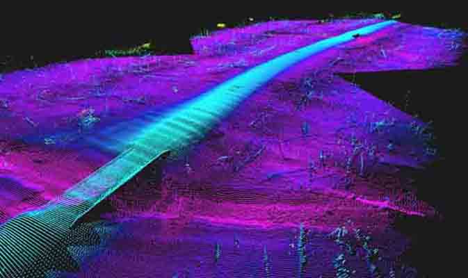
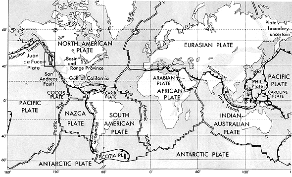
A land bridge that rose from the sea floor because of upthrust at the edge of a continental plate is Central America. The Cocos Plate, an oceanic tectonic plate off the west coast of Central America, is being subducted in a convergent boundary under the North American Plate to the north and the South American Plate to the south. This caused first an island arc and then continuous land to emerge.
Before the theory of Plate Tectonics, it was believed that land bridges could explain the occurrence of species in separate continents. Many land bridges were thought up, cross-crossing large areas of ocean. They also apparently disappeared without a trace - Read more.
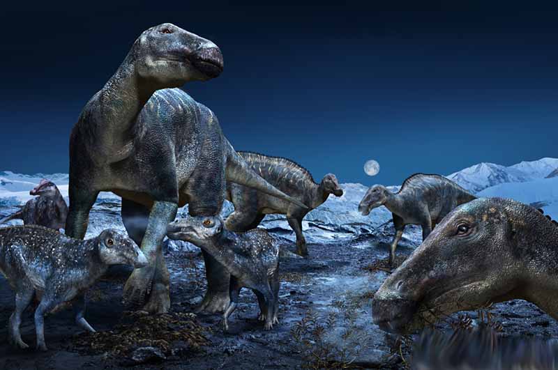
Ancient 'frosty' rhino from Canada's High Arctic rewrites what scientists thought they knew about the North Atlantic Land Bridge Live Science - October 30, 2025
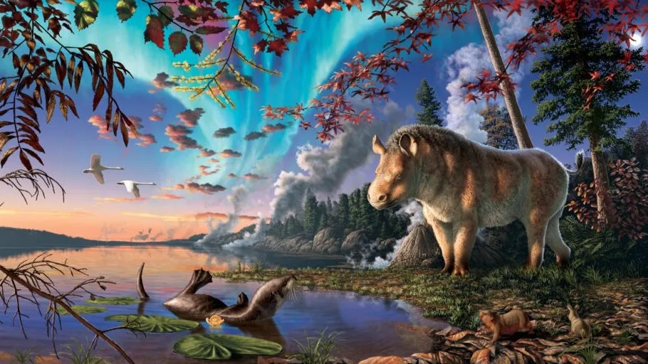
Researchers have gained new insights into rhinoceros evolution and the longevity of the North Atlantic Land Bridge from analyzing the perfectly preserved fossils of a "frosty" Arctic rhino.
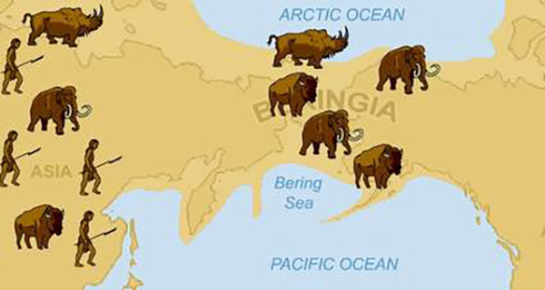
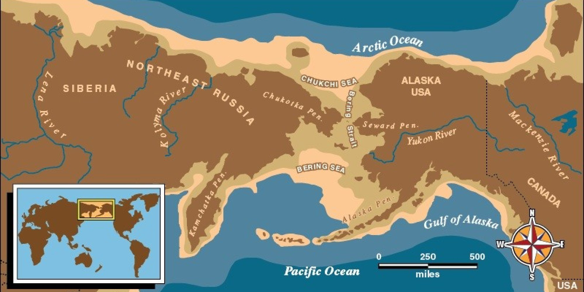
The best-known example of a Land Bridge is the Bering land bridge, which joined present-day Alaska and eastern Siberia at various times during the Pleistocene ice ages, enabling humans to migrate from Eurasia to the Americas. Another land bridge may have connected Great Britain to Europe at around the same time.
Bering Land Bridge emerged much later than we thought it did, new study finds Live Science - October 1, 2025

The Bering Land Bridge likely didn't emerge until around 35,000 years ago, much later than was previously thought. This narrows the window of when humans could have crossed over to North America.
Bering Land Bridge formed much later than originally thought, study suggests Live Science - January 4, 2023

Researchers reconstructed the sea level history of the Bering Land Bridge from 46,000 years ago and found that it didn't emerge until around 35,700 years ago, which is less than 10,000 years before the last ice age, also known as the Last Glacial Maximum. The land bridge existed toward the end of the Pleistocene epoch (2.6 million to 11,700 years ago), a time filled with cold glacial and warm interglacial periods. The land bridge's dates are still debated, with some scientists saying it existed from about 30,000 to 16,000 years ago. The new findings suggest that the growth of the ice sheets, which led to a subsequent drop in sea levels, occurred later in the glacial cycle, with the Bering Strait being open and flooded from at least 46,000 to 35,700 years ago, according to the study.
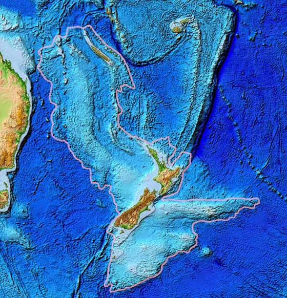
Zealandia also known as the New Zealand continent or Tasmantis is an almost entirely submerged mass of continental crust that subsided after breaking away from Gondwanaland 83-79 million years ago. It has variously been described as a continental fragment, a microcontinent, a submerged continent, and a continent. The name and concept for Zealandia was proposed by Bruce Luyendyk in 1995.
The land mass may have been completely submerged by about 23 million years ago, and most of it (93%) remains submerged beneath the Pacific Ocean. With a total area of 4,920,000 km2 (1,900,000 sq mi), it is the world's largest current microcontinent, more than twice the size of the next-largest microcontinent and more than half the size of the Australian continent. As such, and due to other geological considerations, such as crustal thickness and density, it is arguably a continent in its own right. This was the argument which made news in 2017, when geologists from New Zealand, New Caledonia, and Australia concluded that Zealandia fulfills all the requirements to be considered a continent, rather than a microcontinent or continental fragment. New Zealand geologist Nick Mortimer has commented that "if it wasn't for the ocean" it would have been recognized as such long ago.
Zealandia supports substantial inshore fisheries and contains gas fields, of which the largest known is New Zealand's Maui gas field, near Taranaki. Permits for oil exploration in the Great South Basin were issued in 2007. Offshore mineral resources include iron sands, volcanic massive sulfides and ferromanganese nodule deposits. Read more
Maps reveal new details about New Zealand's lost underwater continent CNN - June 23, 2020
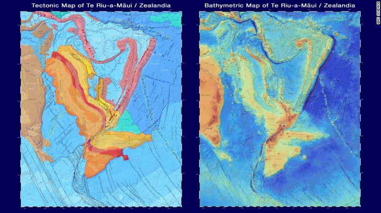
Under New Zealand, there lies a vast continent on the sea floor. Once part of the same land mass as Antarctica and Australia, the lost continent of Zealandia broke off 85 million years ago and eventually sank below the ocean, where it stayed largely hidden for centuries. Now, maps reveal new research about the underwater continent where dinosaurs once roamed - and allow the public to virtually explore it. GNS Science, a New Zealand research institute, published two new maps and an interactive website on Monday. The maps cover the shape of the ocean floor and Zealandia's tectonic profile, which collectively help tell the story of the continent's origins.
The lost continent of Zealandia hides clues to the Ring of Fire's birth Live Science - February 11, 2020
The hidden undersea continent of Zealandia underwent an upheaval at the time of the birth of the Pacific Ring of Fire. Zealandia is a chunk of continental crust next door to Australia. It's almost entirely beneath the ocean, with the exception of a few protrusions, like New Zealand and New Caledonia. But despite its undersea status, Zealandia is not made of magnesium- and iron-rich oceanic crust. Instead, it is composed of less-dense continental crust. The existence of this odd geology has been known since the 1970s, but only more recently has Zealandia been more closely explored. In 2017, geoscientists reported in the journal GSA Today that Zealandia qualifies as a continent in its own right, thanks to its structure and its clear separation from the Australian continent.
Secrets of Earth's sunken 'lost continent' revealed Daily Mail - September 27, 2017
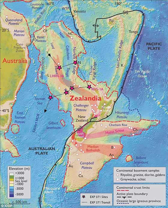
Drilling of Zealandia suggests it was closer to land level than thought, and acted as a bridge for animals 80 million years ago. An international team of scientists found fossilized remains and evidence of large-scale tectonic plate shifts as part of one of the first extensive surveys of the region. The discovery of microscopic shells of organisms that lived in warm shallow seas, and spores and pollen from land plants, reveal that the geography and climate of Zealandia was dramatically different in the past.
95 million-year-old land bridge across Antarctica carried dinosaurs between continents Live Science - April 17, 2023
The first-ever near-complete sauropod skull found in Australia is remarkably similar to fossils from South America, which suggests that dinosaurs roamed across ice-free Antarctica. A nearly 100 million-year-old, exceptionally well-preserved sauropod skull discovered in Australia may show that dinosaurs trudged across Antarctica from South America to Australia, researchers have revealed.