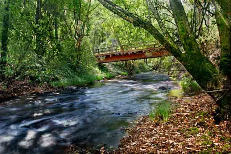
A river is a large natural waterway. The source of a river may be a lake, a spring, or a collection of small streams, known as headwaters. From their source, all rivers flow downhill, typically terminating in the ocean. The mouth, or lower end, of a river is known as its base level.
A river's water is confined to a channel, made up of a stream bed between banks. Most rainfall on land passes through a river on its way to the ocean. Smaller side streams that join a river are tributaries. The scientific term for any flowing natural waterway is a stream; so in technical language, the term river is just a shorthand way to refer to a large stream. Read more ...
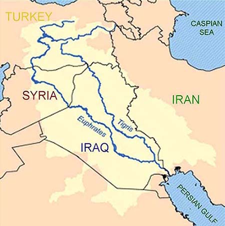
The Tigris is the easternmost of the two great rivers that define Mesopotamia, the other being the Euphrates. The river flows south from the mountains of the Armenian Highlands through the Syrian and Arabian Deserts, and empties into the Persian Gulf. Continue reading
When I wrote the story of Sarah and Alexander - protagonists Sarah and her friend Amaan follow clues to a place where the Tigris and Euphrates Rivers meet, now an almost dried up river bed. Suddenly a UFO emerges from the murky water beaming a light towards a mountain nearby. It was there they have a mystical experience which sets the stage for the end of this chapter of reality. I never thought about any of it happening in real time but apparently the algorithms overlay - one more event that allows me to know we're coming to the end of the simulation.
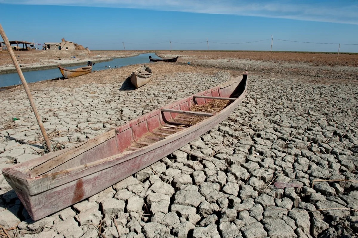
Euphrates River Is Drying Up And Crisis Looms, Just As The Bible Warned Science Alert - March 11, 2023
In the Bible, it's said when the Euphrates river runs dry then immense things are on the horizon, perhaps even the foretelling of the Second Coming of Jesus Christ and the rapture. Revelation 16:12 reads: "The sixth angel poured out his bowl on the great river Euphrates, and its water was dried up to prepare the way for the kings from the East." Not to sound dramatic or anything, but it looks like that time is nigh. Together with the Tigris, the Euphrates carves through present-day Syria and Iraq before emptying into the Persian Gulf. For thousands of years, the twin rivers have allowed farming communities and grand cities to flourish in Mesopotamia, which is considered the cradle of some of the world's earliest civilizations. However, for several decades, it's become increasingly apparent that the Tigris–Euphrates river system is drying out.
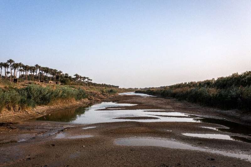
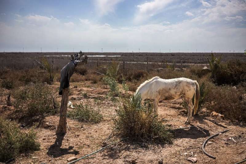
It was the river that is said to have watered the biblical Garden of Eden and helped give birth to civilization itself. But today the Tigris is dying. Human activity and climate change have choked its once mighty flow through Iraq, where - with its twin river the Euphrates - it made Mesopotamia a cradle of civilization thousands of years ago. This summer in Baghdad, the level of the Tigris dropped so low that people played volleyball in the middle of the river, splashing barely waist-deep through its waters.
Rivers begin at their source in higher ground, either rising from a spring, forming from glacial meltwater, flowing from a body of water such as a lake, or simply from damp, boggy places where the soil is waterlogged. They end at their base level where they flow into a larger body of water, the sea, a lake, or as a tributary to another (usually larger) river. In arid areas rivers sometimes end by losing water to evaporation and percolation into dry, porous material such as sand, soil, or pervious rock. The area drained by a river and its tributaries is called its watershed, catchment basin or drainage basin. Watershed is also used however to mean a boundary between drainage basins.
Starting at the mouth of the river and following it upstream as it branches again and again, the resulting river network forms a dendritic (tree-like) structure that is an example of a natural random fractal.
A common misconception, particularly amongst schoolchildren and college students in North America, is that most, or even all, rivers flow from north to south. Rivers in fact flow downhill. Sometimes downhill is from north to south, but equally it can be from south to north, and usually is a complex meandering path involving all directions of the compass.
Rivers flowing downhill, from river source to mouth, do not necessarily take the shortest path. For alluvial streams, straight and braided rivers have very low sinuosity and flow directly down hill, while meandering rivers flow from side to side across a valley. Bedrock rivers typically flow in either a fractal pattern, or a pattern that is determined by weaknesses in the bedrock, such as faults, fractures, or more erodible layers.
The Amazon River Flows Backwards, What Reversed The Flow? IFL Science - January 14, 2025
The Amazon river is the largest drainage system in the world in terms of water volume and its drainage basin. The 6,400 kilometer (4,000 mile) river flows from the Andes Mountains of Peru, crossing South America before emptying into the Atlantic Ocean. However, according to a surprising find in 2006 and subsequent geological studies, that has not always been the case - millions of years in the past, the river flowed in the opposite direction.
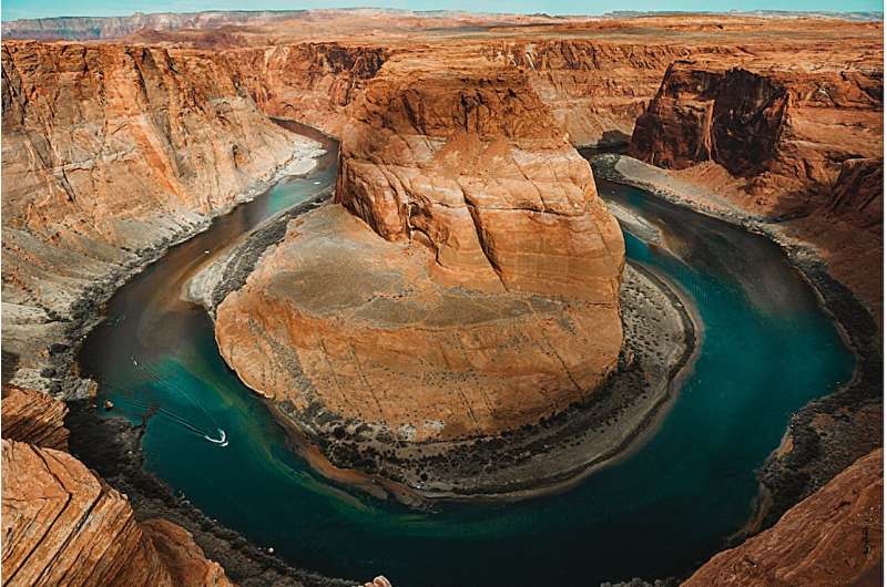
Ancient Colorado river flowed backwards PhysOrg - October 4, 2010
Geologists have found evidence that some 55 million years ago a river as big as the modern Colorado flowed through Arizona into Utah in the opposite direction from the present-day river. Writing in the October issue of the journal Geology, they have named this ancient northeastward-flowing river the California River, after its inferred source in the Mojave region of southern California.
Recently, other researchers have speculated that rivers older than the Colorado River may have carved an ancestral or "proto" Grand Canyon around this time, long before Colorado began eroding the present canyon less than 20 million years ago. But Davis sees no evidence of this. "The Grand Canyon would have been on the river's route as it flowed from the Mojave to Utah, he says. "It stands to reason that if there was major erosion of a canyon going on we would see lots of zircon grains from that area, but we don't."
The mighty California River likely met its end as the Rocky Mountains rose and the northern Colorado Plateau tilted, reversing the slope of the land surface and the direction of the river's flow to create the present Colorado-Green River system. Davis and his colleagues have not determined precisely when the change occurred, however. "The river could have persisted for as long as 20 million years before the topography shifted enough to reverse its flow," he says.

The Styx - also meaning "hate" and "detestation" - is a river in Greek mythology that formed the boundary between Earth and the Underworld (often called Hades which is also the name of this domain's ruler). The rivers Styx, Phlegethon, Acheron, and Cocytus all converge at the center of the underworld on a great marsh, which is also sometimes called the Styx. The important rivers of the underworld are Lethe, Eridanos, and Alpheus.
The gods were bound by the Styx and swore oaths on it. The reason for this is during the Titan war the goddess Styx, the goddess of the river Styx, sided with Zeus. After the war, Zeus promised every oath be sworn upon her. Zeus swore to give Semele whatever she wanted and was then obliged to follow through when he realized to his horror that her request would lead to her death. Helios similarly promised his son Phaeton whatever he desired, also resulting in the boy's death. According to some versions, Styx had miraculous powers and could make someone invulnerable. According to one tradition, Achilles was dipped in it in his childhood, acquiring invulnerability, with exception of his heel, by which his mother held him. This is the source of the expression Achilles' heel, a metaphor for a vulnerable spot.
Styx was primarily a feature in the afterworld of Greek mythology, and similar to the Christian area of Hell in texts such as The Divine Comedy and "Paradise Lost". The ferryman Charon is believed to have transported the souls of the newly dead across this river into the underworld, though in the original Greek and Roman sources, as well as in Dante, it was the river Acheron that Charon plied. Dante put Phlegyas over the Styx and made it the fifth circle of Hell, where the wrathful and sullen are punished by being drowned in the muddy waters for eternity, with the wrathful fighting each other.
In ancient times some believed that placing a coin in the mouth[2] of the deceased would help pay the toll for the ferry to help cross the Styx river which would lead one to the entrance of the underworld. If some could not pay the fee it was said that they would never be able to cross the river. This ritual was performed by the relatives.
The variant spelling Stix was sometimes used in translations of Classical Greek before the 20th century. By synecdoche, the adjective stygian came to refer to anything dark, dismal, and murky.
The Celadon is a mythological river of Arcadia crossed by Heracles in pursuit of the Hind of Ceryneia, according to Pindar: it is mentioned by Strabo. Pausanias names it the Celadus and states that it is a tributary of the Alpheus. In Homer's Iliad it is described as being under the walls of Pheia, not far from the river Iardanus, on the borders of Pylos: Ereuthalion was killed by Nestor here.
Eridanos is a river mentioned in Greek mythology. Virgil considered it one of the rivers of Hades in his Aeneid VI, 659.
Hesiod, in the Theogony, calls it "deep-eddying Eridanos" in his list of rivers, the offspring of Tethys. Herodotus (III, 115) points out that the word Eridanos is essentially Greek in character, and surmises that consequently the river supposed to run around the world is probably a Greek invention. He associated it with the river Po, because the Po was located near the end of the Amber Trail. According to Apollonius of Rhode and Ovid, amber originated from the tears of the Heliades, encased in poplars as dryads, shed when their brother, Phaeton, died and fell from the sky, struck by Zeus' thunderbolt, and tumbled into the Eridanos, where "to this very day the marsh exhales a heavy vapour which rises from his smouldering wound; no bird can stretch out its fragile wings to fly over that water, but in mid-flight it falls dead in the flames;" "along the green banks of the river Eridanos," Cygnus mourned him - Ovid told - and was transformed into a swan. There in the far west, Heracles asked the river nymphs of Eridanos to help him locate the Garden of the Hesperides.
Eridanos is the name that has been applied by geologists to a river which flowed where the Baltic Sea is now, a river system also known simply as the "Baltic River System".
The Sarasvati River is one of the chief Rigvedic rivers mentioned in ancient Sanskrit texts. The Nadistuti hymn in the Rigveda (10.75) mentions the Sarasvati between the Yamuna in the east and the Sutlej in the west, and later Vedic texts like Tandya and Jaiminiya Brahmanas as well as the Mahabharata mention that the Sarasvati dried up in a desert. The goddess Sarasvati was originally a personification of this river, but later developed an independent identity and gained meaning.
The identification of the Vedic Sarasvati River with the Ghaggar-Hakra River was accepted by Christian Lassen, Max Muller, Marc Aurel Stein, C.F. Oldham and Jane Macintosh, while some Vedic scholars believe the Helmand River of southern Afghanistan corresponds to the Sarasvati River.
Other famous Mythological Rivers
Why the Arctic's rivers are rusting now and where toxic orange water could spread next PhysOrg - June 2, 2026

Scientists have identified the two biggest reasons that once-pristine rivers across the Arctic are growing cloudy with toxic orange iron particles that smother insects and suffocate fish. As the climate warms, a layer of Arctic soil that had been frozen for millennia has begun to thaw. Previous studies suggested that thawing permafrost was the ultimate cause of the damage. This new study proves that beyond a shadow of a doubt.
Blog: The Place Where the Tigris Euphrates Rivers Meet
Scientists reveal the origin of the Euphrates - a river that fed the 'cradle of civilization' Live Science - June 2, 2026

Around 5.4 million years ago, two rivers flowed across present-day Turkey and Syria and into the Mediterranean Sea - and eventually, they would merge to form the Euphrates River, new research suggests. The merged river would play a pivotal role in the development of early human civilizations in the Fertile Crescent.
Plate tectonics shaped the Cradle of Civilization by merging two ancient rivers, study suggests PhysOrg - June 2, 2026
Scientists Solve Mystery of Where the Colorado River Vanished Millions of Years Ago SciTech Daily - April 21, 2026
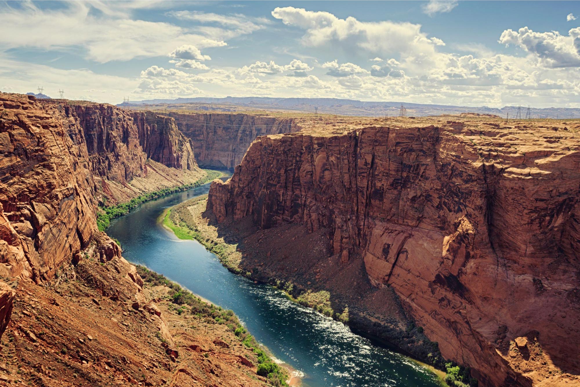
Geologists have uncovered what happened to the Colorado River during a mysterious missing stretch of its history millions of years ago. Research published in Science shows that the river once flowed into a large inland lake for several million years before eventually carving a path into the Grand Canyon. This shift marked its evolution into a continent-spanning river that ultimately reached the Gulf of California.
Shapeshifting 'braided river' in Tibet is the highest in the world, and is becoming increasingly unstable Live Science - October 14, 2025
A 2025 satellite photo shows a particularly complex section of the Yarlung Zangbo River as it twists its way through the Tibetan Plateau. This part of the "braided" waterway has experienced drastic visual changes over recent decades, which could soon be accentuated by climate change.
Orange rivers signal toxic shift in Arctic wilderness PhysOrg - September 10, 2025
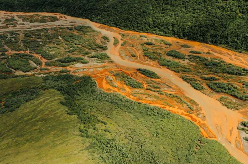
In Alaska's Brooks Range, rivers once clear enough to drink now run orange and hazy with toxic metals. As warming thaws formerly frozen ground, it sets off a chemical chain reaction that is poisoning fish and wreaking havoc on ecosystems. As the planet warms, a layer of permafrost - permanently frozen Arctic soil that locked away minerals for millennia - is beginning to thaw. Water and oxygen creep into the newly exposed soil, triggering the breakdown of sulfide-rich rocks, and creating sulfuric acid that leaches naturally occurring metals like iron, cadmium, and aluminum from rocks into the river. Often times, geochemical reactions like these are triggered by mining operations. But that is not the case this time.
There's a Hidden Water Cycle in The Amazon We Barely Know Anything About Science Alert - June 9, 2024
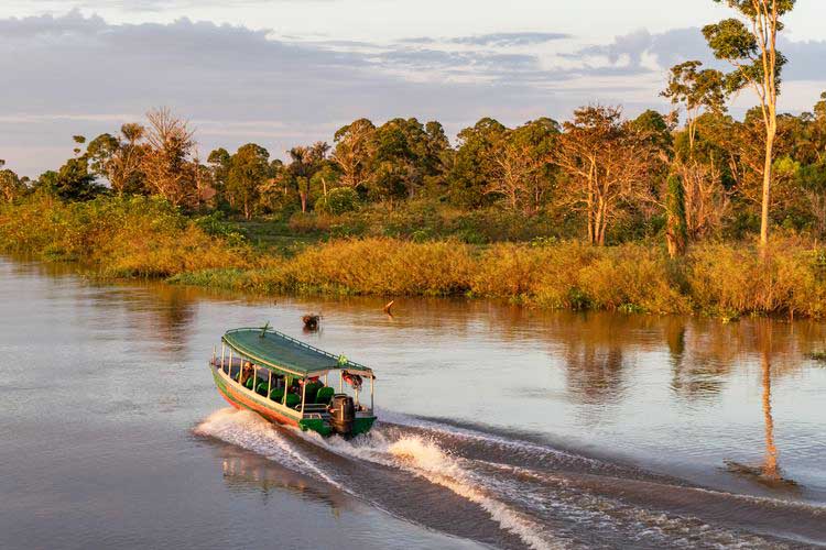
The rivers and tributaries of the Amazon rainforest hold around a fifth of Earth's fresh water, nourishing a stunning variety of mammals, birds, plants and amphibians. It also helps support the 47 million people in the surrounding basin region which includes mountain forests, wetlands, and river systems across nine South American countries.
A Giant Ancient River System Revealed Beneath Antarctica's Ice IFL Science - June 6, 2024

During the mid-late Eocene epoch, 44-34 million years ago, large parts of Antarctica were ice-free, creating room for river systems now long frozen. Sediments from the Amundsen Sea came all the way from the mountain range that spans the continent, revealing there was no inland sea in between to capture them.
The world was a hotter place in general 40 million years ago, but the difference was most stark in Antarctica. Great ocean currents drew warm water down from the equator to lap at its margins, before the formation of the Antarctic Circumpolar Current blocked their passage. Consequently, while the highlands were glaciated, and the lowlands got snowy in winter, forests flourished.
Forests need rain, and regular rain means rivers. However, identifying where these ran is challenging. There has been plenty of time for the landscape to change since the ice came. Consequently, we can't just look at the current lie of the land and assume water flowed to what is now the lowest point.
The mighty Mississippi, America's water highway, is dangerously low PhysOrg - October 24, 2023
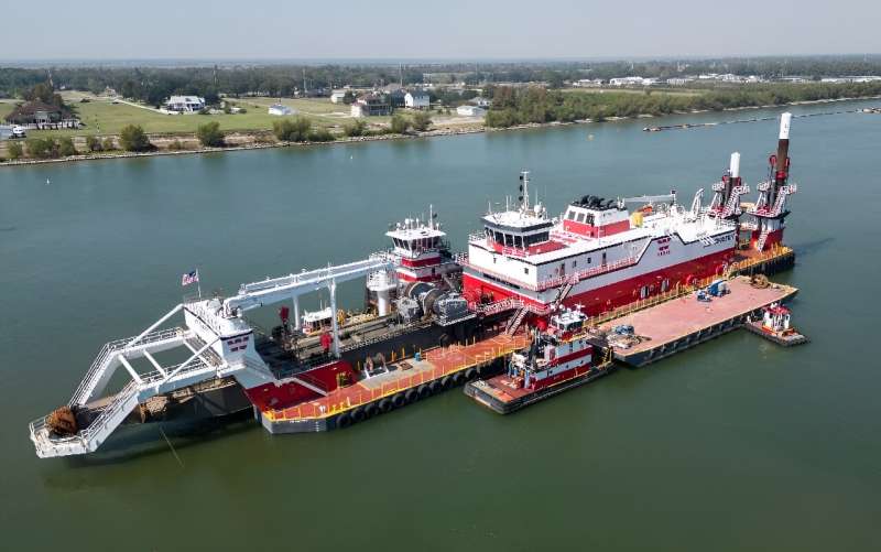
In the middle of the shrunken Mississippi, a barge drags a giant metal-edged suction head along the riverbed to remove sediment from shipping lanes. The crew of the dustpan dredge Hurley has been working around-the-clock for months to deepen the channels so boats and barges can pass through.
The Rio Grande isn't just a border - it's a river in crisis PhysOrg - October 24, 2023
The Rio Grande is one of the longest rivers in North America, running some 1,900 miles (3,060 kilometers) from the Colorado Rockies southeast to the Gulf of Mexico. It provides fresh water for seven U.S. and Mexican states, and forms the border between Texas and Mexico, where it is known as the Río Bravo del Norte. The river's English and Spanish names mean, respectively, "large" and "rough." But viewed from the Zaragoza International Bridge, which connects the cities of El Paso, Texas, and Ciudad Juárez, Mexico, what was once mighty is now a dry riverbed, lined ominously with barbed wire.
Colorado River Basin megadrought caused by massive 86% decline in snowpack runoff PhysOrg - July 29, 2023
The Colorado River Basin provides freshwater to more than 40 million people within the semi-arid southwestern United States, including major cities such as Las Vegas and Los Angeles. However, between 2000 and 2021 the basin experienced a megadrought (a severe drought lasting multiple decades), which researchers have suggested likely would not have occurred if it were not for anthropogenic climate change. In particular, during 2020 and 2021, the river basin recorded the driest 20-month period since 1895 and the lowest river flow since 1906.
Each spring, a large tripod placed on the ice of the Tanana River in the town of Nenana, Alaska, is watched closely to determine the winner(s) of a jackpot. The Nenana Ice Classic which is referred to as Alaska's oldest guessing game, began in 1917, when a group of engineers placed bets on when the river ice would break up.
Now, people purchase $3 tickets marked with the day and time they think the ice under the tripod will break up enough that the tripod will move 100 feet down the river, triggering a unique pulley system that stops an old analogue clock. This year's jackpot is a whopping $222,101, meaning plenty of people are likely eagerly watching the event's live webcam to see if they will win. Weather Channel - April 27, 2023
The Source Of River Nile Still Mystifies After Thousands Of Years IFL Science - March 13, 2023
The Nile is the longest river in the world, flowing through northeastern Africa for over 6,650 kilometers (4,132 miles). The simple answer is that the River Nile has two main sources: the Blue Nile from Ethiopia - which contributes two-thirds of all the Nile discharge - as well as the White Nile from the African Great Lakes and beyond. However, if we take a few steps back in history, we'll see things get a little less clear-cut. The ancient Romans had the proverb "Nili caput quaerere," which is Latin for "to search for the head of the Nile.> It was used to describe a mad endeavor, striving for the unattainable or impossible
The Amazon Isn't The Only Giant Waterway In Brazil, Another Hides Underground IFL Science- February 10, 2023
River Hamza, as Brazil's National Observatory unofficially named the beast, acts like drainage for the region and was discovered after Petrobras (an oil company) drilled hundreds of wells. They were drilled back in the 70s and 80s, but when scientists later took a look inside they discovered the monstrous waterway that was hiding underneath. It was after the leader of this team of researchers that the underground waterway was named. It begins under the Andes in the Acre region and winds its way on through to the Solimoes, Amazonas and Marajo basins before slipping out unseen into the Atlantic Ocean. The flowing river Amazon speeds along at around 5 meters (16 feet) per second.
Salt water creeps toward New Orleans up Mississippi River PhysOrg - September 29, 2022
Drought upriver has left the Mississippi River so low and slow that salt water is creeping farther than usual along the bottom toward New Orleans and threatening drinking water.
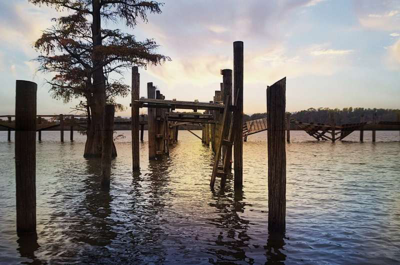
An estuary is a partially enclosed coastal body of brackish water with one or more rivers or streams flowing into it, and with a free connection to the open sea. Estuaries form a transition zone between river environments and maritime environments and are an example of an ecotone. Estuaries are subject both to marine influences such as tides, waves, and the influx of saline water, and to fluvial influences such as flows of freshwater and sediment. The mixing of seawater and freshwater provides high levels of nutrients both in the water column and in sediment, making estuaries among the most productive natural habitats in the world.
Most existing estuaries formed during the Holocene epoch with the flooding of river-eroded or glacially scoured valleys when the sea level began to rise about 10,000-12,000 years ago. Estuaries are typically classified according to their geomorphological features or to water-circulation patterns. They can have many different names, such as bays, harbors, lagoons, inlets, or sounds, although some of these water bodies do not strictly meet the above definition of an estuary and could be fully saline.
Many estuaries suffer degeneration from a variety of factors including soil erosion, deforestation, overgrazing, overfishing and the filling of wetlands. Eutrophication may lead to excessive nutrients from sewage and animal wastes; pollutants including heavy metals, polychlorinated biphenyls, radionuclides and hydrocarbons from sewage inputs; and diking or damming for flood control or water diversion. Continue reading
Study shows unprecedented changes to world's rivers PhysOrg - September 13, 2022
In the past 40 years, humans have caused unprecedented, consequential changes to river sediment transport. Humans have been able to alter the world's biggest rivers at rates that are unprecedented in the recent geologic record. The findings show that widespread 20th-century dam building in Earth's northern areas - North America, Europe and Asia - reduced the global delivery of water-borne sediment from rivers to the oceans by 49% relative to pre-dam conditions. However, in Earth's southern areas - South America, Africa and Oceania - sediment transport has increased in 36% of rivers due to major land-use changes, most of which are associated with deforestation.
river.html. See how 6 look from space CNN - August 20, 2022
A painful lack of rain and relentless heat waves are drying up rivers in the US, Europe, Asia and the Middle East. Many are shrinking in length and breadth. Patches of riverbed poking out above the water are a common sight. Some rivers are so desiccated, they have become virtually impassable. The human-caused climate crisis is fueling extreme weather across the globe, which isn't just impacting rivers, but also the people who rely on them. Most people on the planet depend on rivers in some way, whether for drinking water, to irrigate food, for energy or to ship goods.
New models detail how major rivers will respond to changing environmental conditions PhysOrg - July 13, 2020
From the Nile to the Mississippi and from the Amazon to the Yangzi, human civilization is inextricably linked to the great rivers along which our societies developed. But rivers are mutable, and the benefits they bestow can quickly become disasters when these waterways change course. Scientists are working to understand how environmental changes alter river dynamics.
The Mississippi River has many nicknames. Now it has a new one: America's 'most endangered river.' PhysOrg - April 14, 2020
The upper Mississippi River, from its headwaters in Minnesota to the southern tip of Illinois, has been named the most endangered river in the United States. Citing record-breaking flooding in 2019, which left cities, towns, farm fields and marshlands along the river waterlogged for months, the group urged federal, state and regional leaders to work toward solutions that allow the landscape to hold more water and give the river room to flood safely.
Atmospheric rivers getting warmer along U.S. West Coast PhysOrg - June 25, 2019
Most of the West Coast of the United States relies on a healthy winter snowpack to provide water through the dry summer months. But when precipitation falls as rain rather than snow, it can diminish summer water supplies, as well as trigger floods and landslides.
Is this the world's first polluted river? Daily Mail - December 5, 2016
7,000-year-old waterway in Jordan may have been contaminated by Neolithic humans making metal tools. At this time, copper was created by combining charcoal and blue-green copper ore and heating the mixture over a fire. The process was time-consuming and labour-intensive and so it took thousands of years before copper became a central part of human societies. Many of the objects created during the early phases of copper production were symbolic. They were considered exotic and were a sign of prestige within society. Gradually, the copper production expanded and mines, smelting furnaces and factories were built by around 2600 BC.
Secret World of Primeval Rivers Lies Beneath Greenland Glacier Live Science - July 5, 2016
A network of ancient rivers lies frozen in time beneath one of Greenland's largest glaciers, new research reveals. The subglacial river network, which threads through much of Greenland's landmass and looks, from above, like the tiny nerve fibers radiating from a brain cell, may have influenced the fast-moving Jakobshavn Isbrae glacier over the past few million years. The channels seem to be instrumental in controlling the location and form of the Jakobshavn ice stream - and seem to show a clear influence on the onset of fast flow in this region.
Amazon river 'switched direction' BBC - October 24, 2006
Over millions of years, the Amazon has reversed its flow. The world's largest river, the Amazon, once flowed from the Atlantic Ocean to the Pacific - the opposite of its present direction, a study shows. Sedimentary rocks in the central part of South America contain ancient mineral grains that must have come from the eastern part of the continent. Geologist Russell Mapes says this must mean that about 145-65 million years ago, the Amazon flowed east to west. The age of rocks on the South American continent differs between east and west. Rocks as old as 2.5 billion years are found on the eastern side of the continent. Because of continual geological activity in the Andes, on the western side, rocks there are much younger.....