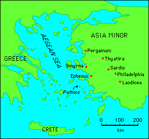
Anatolia or Asia Minor is a region of Western Asia, comprising most of the modern Republic of Turkey. It is a geographic region bounded by the Black Sea to the north, the Caucasus to the northeast, the Aegean Sea to the west, the Mediterranean Sea to the south, and the Iranian plateau to the east and southeast.
Anatolia dates back at least 3,000 years, from the Ionian settlement period in the 1st millennium BC. The Byzantine Greek term Anatolicon ("Eastern") signified the lands to the east of Europe and of the Roman Empire's late-era capital city of Constantinople, also New Rome (now "Istanbul"). The etymology of the word supports the idea that Anatolia was a peninsula bordered by the Black Sea, the Mediterranean Sea, and the Eastern Taurus Range.
he Anatolian peninsula is bounded by the Black Sea to the north, the Mediterranean Sea to the south, the Aegean Sea (itself an arm of the Mediterranean) to the west, and the bulk of the Asian mainland to the east.
Anatolia's terrain is structurally complex. A central massif composed of uplifted blocks and downfolded troughs, covered by recent deposits and giving the appearance of a plateau with rough terrain, is wedged between two folded mountain ranges that converge in the east. True lowland is confined to a few narrow coastal strips along the Black Sea and Mediterranean Sea coasts. Flat or gently sloping land is rare and largely confined to the deltas of the Kizil River, the coastal plains of Cukurova, and the valley floors of the Gediz River and the Buyuk Menderes River, and some interior high plains in Anatolia, mainly around Tuz Golu (Salt Lake) and Konya Ovasi (Konya Basin).
The Black Sea region has a steep, rocky coast with rivers that cascade through the gorges of the coastal ranges. The North Anatolian mountains are an interrupted chain of folded highlands that generally parallel the Black Sea coast. A few larger rivers, those cutting back through the Pontic Mountains (Turkish: Kackar Daglan), have tributaries that flow in broad, elevated basins. Rivers flow from the mountains toward the Black Sea trough in lengthy valleys.
Access inland from the coast is limited to a few narrow valleys because mountain ridges, with elevations of 1,525 to 1,800 meters (5,000 to 5,900 ft) in the west and 3,000 to 4,000 meters (10,000 to 13,000 ft) in the east in Kackar Mountains, form an almost unbroken wall separating the coast from the interior. The higher slopes facing southwest tend to be densely wet. Because of these natural conditions, the Black Sea coast historically has been isolated from Anatolia. The southern slopes - facing the Anatolian Plateau - are mostly unwooded, but the northern slopes contain dense growths of both deciduous and evergreen trees.
Eastern Anatolia where the Pontus and Taurus mountain ranges converge, is rugged country with higher elevations, a more severe climate, and greater precipitation than are found on the Anatolian Plateau. The region is known as the Anti-Taurus, and the average elevation of its peaks exceeds 3,000 m. Mount Ararat, at 5,137 meters (16,854 ft) the highest point in Turkey, is located in the Anti-Taurus. Lake Van is situated in the mountains at an elevation of 1,546 meters (5,072 ft). The headwaters of three major rivers arise in the Anti-Taurus: the east-flowing Aras River, which empties into the Caspian Sea; the south-flowing Euphrates and Tigris join in Iraq before emptying into the Persian Gulf. Several small streams that empty into the Black Sea or landlocked Lake Van also originate in these mountains.
Southeast Anatolia lies south of the Anti-Taurus Mountains. It is a region of rolling hills and a broad plateau surface that extends into Syria. Elevations decrease gradually, from about 800 meters (2,600 ft) in the north to about 500 meters (1,600 ft) in the south. Traditionally, wheat and barley were the main crops of the region, but the inauguration of major new irrigation projects in the 1980s has led to greater agricultural diversity and development.
The narrow coastal plains of the Mediterranean region, separated from the Anatolian plateau by the Taurus Mountains, which reach elevations of 2,000 to 2,750 meters (6,600 to 9,000 ft), are cultivated intensively. Fertile soils and a warm climate make the Mediterranean coast ideal for growing citrus fruits, grapes, figs, bananas, various vegetables, barley, wheat, and, in irrigated areas, rice and cotton. The Cukurova in the east is a plain that is the most developed agricultural area of the Mediterranean region.
Stretching inland from the Aegean coastal plain, Central Anatolia occupies the area between the two zones of the folded mountains, extending east to the point where the two ranges converge. The plateau-like, semiarid highlands of Anatolia are considered the heartland of the country. The region varies in elevation from 600 to 1,200 meters (2,000 to 4,000 ft) from west to east. The two largest basins on the plateau are the Konya Ovasi and the basin occupied by the large salt lake, Tuz Golu. Both basins are characterized by inland drainage. Wooded areas are confined to the northwest and northeast of the plateau.
The Taurus Mountains close to the coast prevent Mediterranean influences from extending inland, giving the interior of Turkey a continental climate with distinct seasons. The Anatolian Plateau is much more subject to extremes than are the coastal areas. Winters on the plateau are especially severe. The driest regions are the Konya Ovasi and the Malatya Ovasi, where annual rainfall frequently is less than 300 mm (11.8 inches). May is generally the driest month and July and August are the wettest.
The History of Anatolia encompasses the region known as Anatolia (Turkish: Anadolu), known by the Latin name of Asia Minor, considered to be the westernmost extent of Western Asia. Geographically it encompasses what is most of modern Turkey, from the Aegean Sea to the mountains on the Armenian border to east and by the Black Sea and the Taurus mountains from north to south.
The earliest representations of culture in Anatolia can be found in several archaeological sites located in the central and eastern part of the region. Although the origins of some of the earliest peoples are shrouded in mystery, the remnants of Hattian, Akkadian, Assyrian, and Hittite culture provides us with many examples of the daily lives of its citizens and their trade. After the fall of the Hittites, the new states of Phrygia and Lydia stood strong on the western coast as Greek civilization began to flourish. Only the threat from a distant Persian kingdom prevented them from advancing past their peak of success.
As Persia grew, their system of local control in Anatolia allowed many port cities to grow and to become very wealthy. Their governors did revolt from time to time, but it did not really pose a serious threat. Alexander the Great finally wrested control of the whole region from Persia in successive battles and achieved marked victories over his Persian foe Darius III. After his death, his conquests were split amongst several of his trusted generals and survived under constant threat of invasion from both the Gauls and other powerful rulers in Pergamon, Pontus, and Egypt. The Seleucid Empire, largest of the divided territories of Alexander, eventually was bled off by Roman interest in Anatolia and conquered or given away piecemeal.
Roman control of Anatolia was strengthened by a 'hands off' approach by Rome, allowing local control to govern effectively and providing military protection. During the reign of Constantine the Great, a new eastern empire was established at Constantinople, known as the Byzantine Empire. It succeeded initially due to its vast wealth and judicious rulers, but soon suffered from widespread neglect and a new empire borne from the earlier Mongol advance, the Turks. Seljuk and Ilkhanate armies soon whittled down the wide scope of Byzantine influence and trade by the gradual overrun of vital trading centers. The most powerful Turkish empire, that of the Ottomans, finally dealt the Byzantine Empire its death blow when Sultan Mehmet II conquered Constantinople in 1453.
The Ottoman Empire in Anatolia allowed other religions to maintain themselves long after 1453, and built upon their success by enlarging their territories, from North Africa to Europe beyond Thrace. Wars with Russia and other peoples in revolt prevented the Ottomans from taking advantage of their powerful position, and declined under ineffective leadership. Even their highly skilled army, the janissaries, were eventually disbanded after an attempted revolt. Reforms designed to improve the economy back fired as burdensome taxes and levies turned away profitable trade, and desperation allowed the Empire to be sucked into World War I on the side of Germany and Austria. Following their defeat in the war, the Ottoman Empire was carved up and was now limited to Anatolia, but Greek aims in the region caused new tensions that boiled over into full-scale war. It was this war that allowed Mustafa Kemal Ataturk to make Anatolia into the new Republic of Turkey by defeating the Greeks and abolishing the Ottoman government for good in 1922. Since that time, Turkey has grown into a modern state that has enjoyed relative peace in Anatolia.