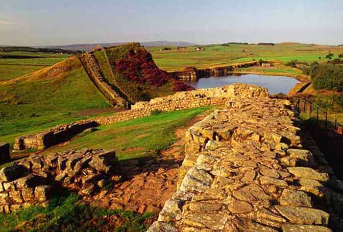
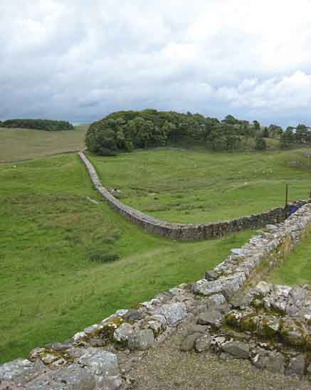
Hadrian's Wall is a stone and turf fortification built by the Roman Empire across the width of modern-day England. It was the second of three such fortifications built across Great Britain, the first being Gask Ridge and the last the Antonine Wall. All three were built to prevent military raids by the Pictish tribes (ancient inhabitants of Scotland) to the north, to improve economic stability and provide peaceful conditions in the Roman province of Britannia to the south, and to mark physically the frontier of the Empire. Hadrian's Wall is the best known of the three because its physical presence remains most evident today.
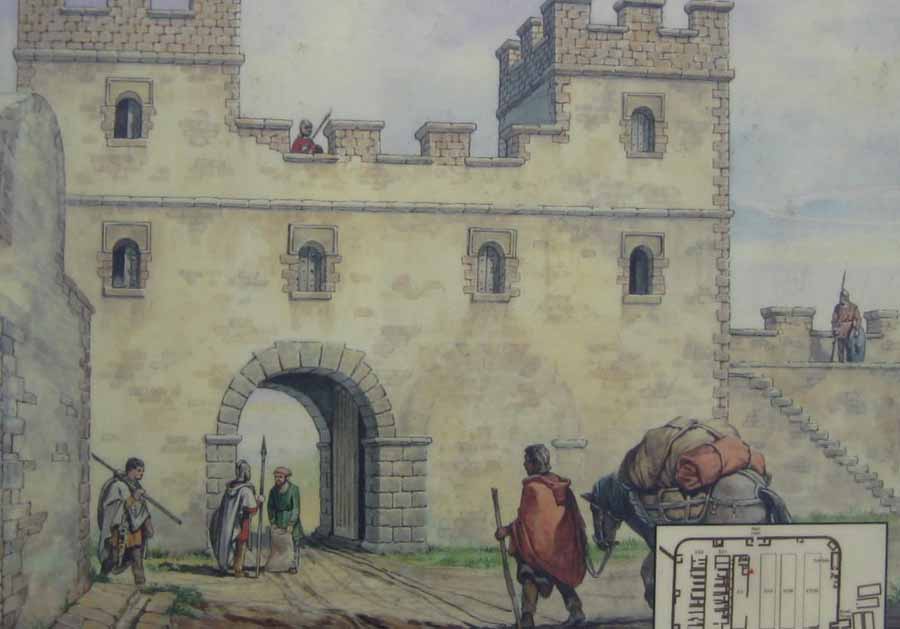
The wall marked the northern limes in Britain and also the most heavily fortified border in the Empire. In addition to its use as a military fortification, it is thought that the gates through the wall would also have served as customs posts to allow trade taxation.
A significant portion of the wall still exists, particularly the mid-section, and for much of its length the wall can be followed on foot. It is the most popular tourist attraction in Northern England, where it is often known simply as the Roman Wall. It was made a UNESCO World Heritage Site in 1987. English Heritage, a government organization in charge of managing the historic environment of England, describes it as "the most important monument built by the Romans in Britain".
In the years after Hadrian's death in 138, the new emperor, Antoninus Pius essentially abandoned the wall, leaving it occupied in a support role, and began building a new wall in Scotland proper, about 160 kilometres (100 mi) north, called the Antonine Wall. This turf wall ran 40 Roman miles (about 37.8 mi or 61 km) and had significantly more forts than Hadrian's Wall. Antoninus was unable to conquer the northern tribes, so when Marcus Aurelius became emperor he abandoned the Antonine Wall and reoccupied Hadrian's Wall as the main defensive barrier in 164. The wall remained occupied by Roman troops until their withdrawal from Britain.
In the late fourth century, barbarian invasions, economic decline, and military coups loosened the Empire's hold on Britain. By 410, the Roman administration and its legions were gone, and Britain was left to look to its own defences and government. The garrisons, by now probably made up mostly of local Britons who had nowhere else to go, probably lingered on in some form for generations. Archaeology is beginning to reveal that some parts of the wall remained occupied well into the fifth century. Enough also survived in the eighth century for spolia from it to find its way into the construction of Jarrow Priory, and for Bede to see and describe the wall thus in Historia Ecclesiastica 1.5, although he misidentified it as being built by Septimius Severus:
But in time the wall was abandoned and fell into ruin. Over the centuries and even into the twentieth century a large proportion of the stone was reused in other local buildings.
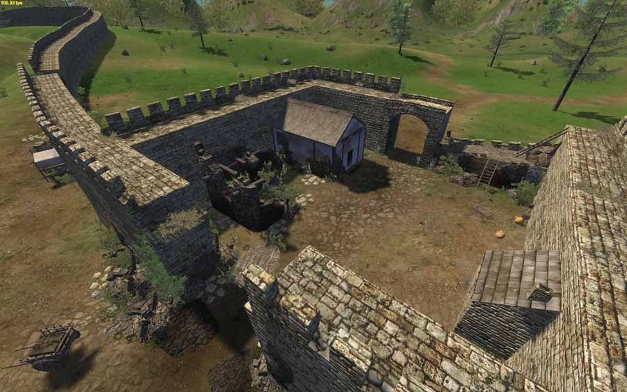
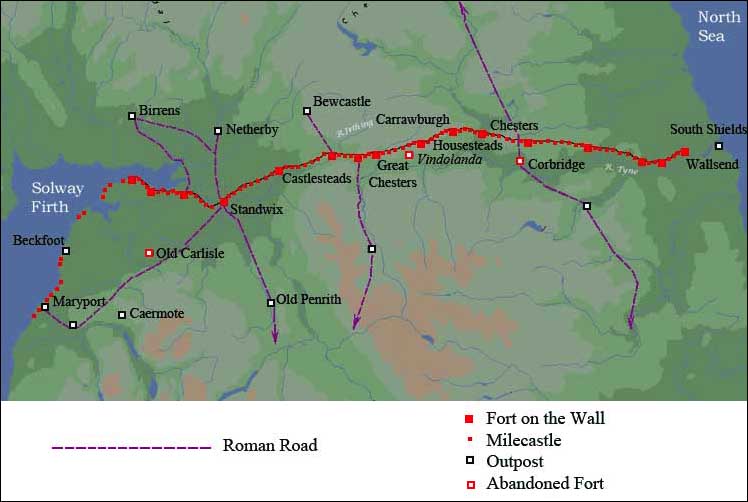
Much of the wall has disappeared. The preservation of what remains can be credited to John Clayton. He trained as a lawyer and became town clerk of Newcastle in the 1830s. He became enthusiastic about preserving the wall after a visit to Chesters. To prevent farmers taking stones from the wall, he began buying some of the land on which the wall stood. In 1834 he started purchasing property around Steel Rigg. Eventually he had control of land from Brunton to Cawfields. This stretch included the sites of Chesters, Carrawburgh, Housesteads and Vindolanda. Clayton carried out excavation work at the fort at Cilurnum and at Housesteads, and he excavated some milecastles.
Clayton managed the farms he had acquired and succeeded in improving both the land and the livestock. His successful management produced a cash flow which could be invested in future restoration work.
Workmen were employed to restore sections of the wall, generally up to a height of seven courses. The best example of the Clayton Wall is at Housesteads. After ClaytonŐs death, the estate passed to relatives and was soon lost at gambling. Eventually the National Trust began the process of acquiring the land on which the wall stands.
At Wallington Hall, near Morpeth, there is a painting by William Bell Scott, which shows a centurion supervising the building of the wall. The centurion has been given the face of John Clayton.
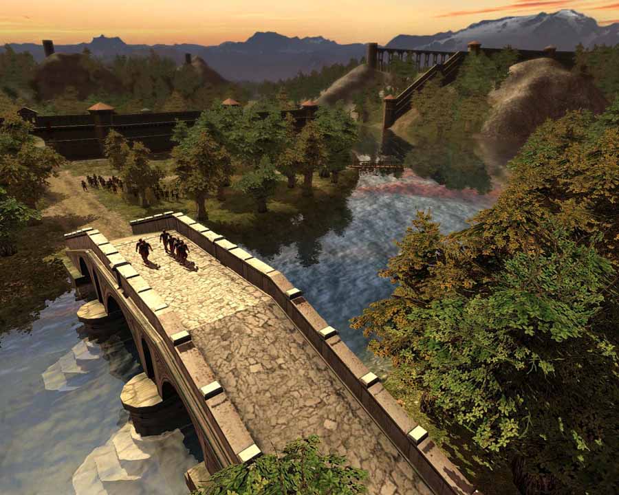
In 2003, a National Trail footpath was opened which follows the line of the wall from Wallsend to Bowness-on-Solway. Because of the fragile landscape, walkers are asked only to follow the path in summer months.
Hadrian's Wall was declared a World Heritage Site in 1987, and in 2005 it became part of the larger "Frontiers of the Roman Empire" World Heritage Site which also includes sites in Germany.
Secret 'Slave' Tunnels Discovered Under Roman Emperor's Villa Live Science - September 6, 2013
Amateur archaeologists have uncovered a massive network of tunnels under the Roman Emperor Hadrian's Villa in Tivoli, Italy. The underground passageways likely allowed thousands of slaves and merchants to keep the estate running without creating any distraction at the street level. Though similar tunnels have been discovered at the complex before, the new discovery is exciting because the passageways were not mentioned in any ancient plans of the grounds.
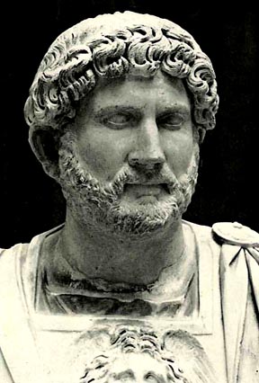
HADRIAN